Celestial Navigation: From Ancient Astrolabes to Modern GPS
Celestial navigation is the practice of determining location in time and space by reference to the position of astronomical bodies, primarily the sun and certain fixed stars such as Polaris, the North Star. Reference to the night sky as a navigational tool is as old as human beings have traveled the Earth, but it was not a particularly reliable craft until the development of increasingly precise instruments. At sea, tools for celestial navigation made finding one’s way across open water more accurate and much safer, enabling consistent transoceanic travel.
Early sea travelers made use of the stars and the sun primarily to determine latitude (the position on the north-to-south axis). Polynesian sailors memorized the succession of fixed stars as they rose in the eastern night sky, each star rising at a known direction (e.g., east, northeast, north), permitting them to estimate their latitude and direction. The Polynesians also used a latitude hook, essentially a T-shaped stick, to measure changes in angle for Polaris, which allowed them to determine relative changes in latitude. The Norse also used a notched stick as early as the late eighth century CE, which allowed for rough measurements of changes in latitude.
The greatest advance of antiquity was the astrolabe, a type of celestial computer. Primitive machines that could tell time by tracking the arrangement of stars were likely in use by at least the first century BCE, but the earliest description of a true astrolabe used for maritime navigation dates from the sixth century CE. The astrolabe consisted of a wheel with a stereographic projection (a two-dimensional representation of the three-dimensional night sky) of the bright stars overlaid on a map of coordinates of an observer’s position at different latitudes. The astrolabe famously had hundreds of applications, but the most fundamental to navigation were determining time and latitude. If you knew the angle of Polaris over a certain location (for example, the major seaports of the world), you could estimate your distance from that place by measuring the discrepancy with the angle of Polaris found at your present position.
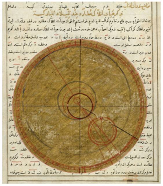
Illustration of an astrolabe, from the book of the birth of Iskandar, c. 1411. An astrolabe was a type of scientific instrument used by early astronomers and seafarers to determine the position of celestial bodies (Wellcome Library, London)
Another early navigational instrument used to measure the angle of fixed stars was the kamal (an Islamic invention dating to roughly the ninth century CE). Consisting of a wooden card with a knotted rope pulled through a hole in the middle, the navigator held the card at arm’s length with the bottom line resting on the horizon and the rope between their teeth. The card would be moved along the rope until the top line occluded a target star (preferably Polaris). Each knot represented about 1.5 degrees of arc, and so by counting the number of knots passed through the card, the altitude of Polaris could be calculated.
The invention of the marine sextant in the early eighteenth century was an important advance in making accurate observations. A split-image telescope view, through the use of mirrors, allowed the observer to line up a celestial body like the sun with the horizon and provided a precise measurement of the angle of the object in arcminutes. According to the Babylonian astronomical system, universally in use, the hemisphere of the night sky is divided into 360 degrees—each degree represents one day of the movement of the fixed stars (it takes a year or roughly 360 days for the sky to do a complete turn). The more precise one’s knowledge of a celestial body’s position, the more precise the calculations in determining present position and distance to destination. Even a small error created a very serious misdirection. The measurements given by a sextant are used in reference to nautical almanacs that provide detailed information about the night sky (for instance, the declination of the sun for every minute of the year).
Around the same time, the English clockmaker John Harrison (1693-1776) solved the problem of determining longitude (position on the east-to-west axis) at sea. Until then, there was no accurate way to know where one was east or west. The resolution to the problem was in comparing the time of day where one was to the time of day at a fixed position. Greenwich, England, came to be recognized as this position or falling on the line of the prime meridian, hence the importance of Greenwich Mean Time (GMT). Harrison’s invention, the marine chronometer, was a clock capable of keeping GMT, regardless of environmental or structural disturbances, such as temperature or the rocking of the ship.
A navigator could compare their own time of day to GMT and establish how many time zones (the sphere of the Earth was allocated into north-to-south meridian lines outward from Greenwich) away they were from Greenwich and thus their longitude. This represented a major breakthrough in determining position and avoiding disasters at sea.
Celestial navigation in the present day relies on the Global Positioning System (GPS). A GPS receiver monitors the signals transmitted by at least four satellites to calculate three position coordinates and clock deviation from satellite time. The GPS system is so accurate and reliable that it has largely replaced the old methods of navigation, but these older methods continue to be taught to and learned by professional mariners because one never knows when the power will go out. Steven Henry Martin
FURTHER READING:Burch, David and Tobias Burch. 2015. Celestial Navigation: A Complete Home Study Course, Second Edition. Seattle: Starpath Publications.
Fagan, Brian. 2012. Beyond the Blue Horizon: How the Earliest Mariners Unlocked the Secrets of the Oceans. London: Bloomsbury Publishing.
Ifland, Peter. 1998. Taking the Stars: Celestial Navigation from Argonauts to Astronauts. Malabar: Kreiger Publishing Company.
Date added: 2025-10-14; views: 354;