Astronomical Fundamentals: Position of the Sun. Solar Position Diagrams
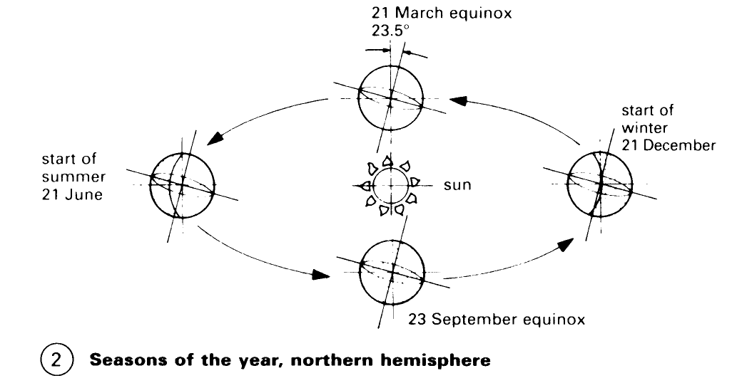
The radiation and light sources which give rise to daylight are not constant. The sun is the 'primary light source' of daylight - (2) whatever the condition of the sky. The axis of inclination of the Earth (23.5°), the daily rotation of the Earth around its own axis and the rotation of the Earth around the sun over a period of 1 year determine the position of the sun as a function of the time of year and the day for each point on the surface of the Earth – (2).
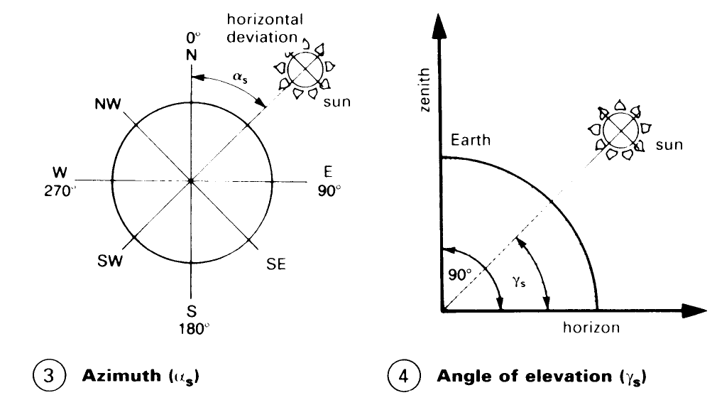
The position of the Earth is defined by two angles: the azimuth, as, and the angle of elevation, λs. On a plan view (3), the azimuth is the horizontal deviation of the position of the sun from 0°, where 0° = north, 90° = east, 180° = south and 270° = west as seen by the observer. On a vertical projection (4), the angle of elevation is the position of the sun over the horizon as seen by the observer.
A number of measuring methods are used to determine the position of the sun at a given location, for example determination of the degree of latitude and the angle of elevation.
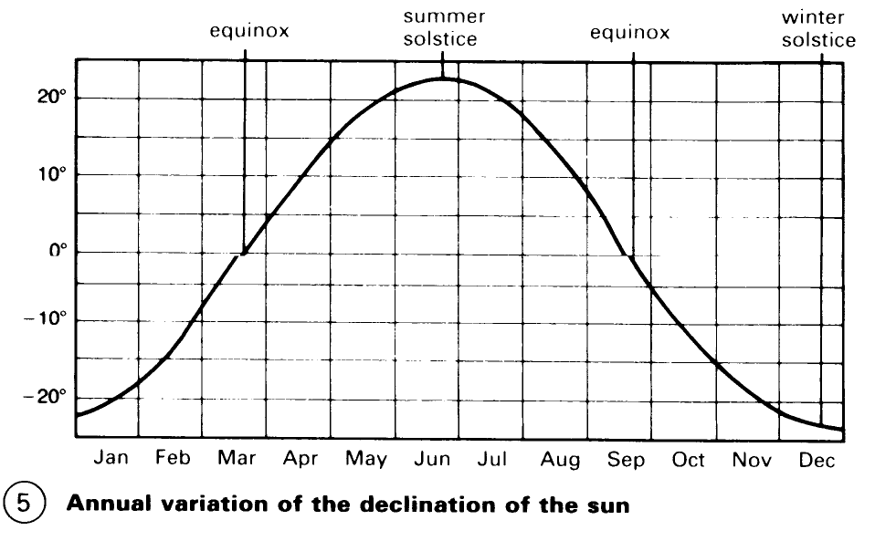
The declination of the sun during the annual cycle results in four main seasons in the year. The equinoxes are on 21 March and 23 September; this is when the declination of the sun is 0°. The winter solstice occurs on 21 December (the shortest day), when the declination of the sun is -23.5°; the summer solstice occurs on 21 June (the longest day), when the declination of the sun is +23.5° (see next page, (5)).
The position of the sun is given by the degree of latitude. On 21 March and 23 September, at 12.00 (as = 180°), the zenith angle of the sun at any latitude is of the same magnitude as the angle of latitude. For example, at 51° north (Brighton), the zenith angle at 12.00 (as = 180°) is 51° (see next page, (6)). The angle of elevation of the sun above the horizontal is 90° - 51° = 39°.
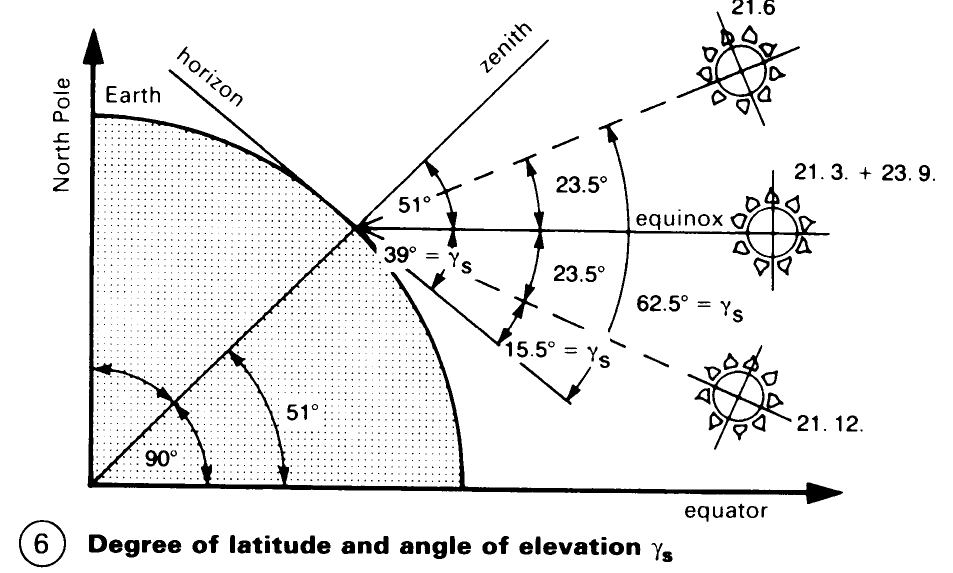
On 21 June, at midday, 12.00 (as = 180°), the sun is 23.5° higher than on 21 March and 23 September: 39° + 23.5° = 62.5°. On the other hand, on 21 December the sun is 23.5° lower than at the equinox: 39° - 23.5° = 15.5°. These deviations are the same for all degrees of latitude.
Thus, the angle of elevation of the sun, corresponding to the time of year, can be determined for all degrees of latitude.
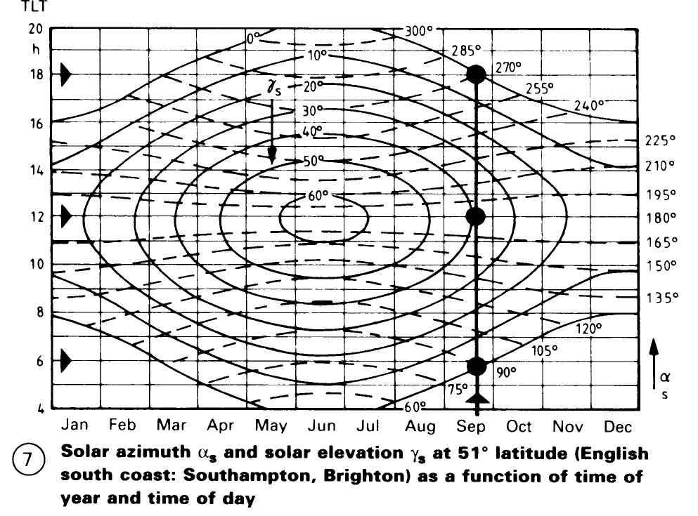
Solar position diagrams. An example is shown of a solar position diagram for 51°N – (7). The diagram shows the plan projection of the position of the sun, in terms of azimuth and elevation, at true local time, e.g. for Brighton on 23 September, sunrise is at 6.00 at and the elevation angle is 39°; sunset is at 18.00, as = 270°, on the same day.
To determine the local course of the sun, a coloured solar position chart is used – (8). The chart contains the plan projection of the azimuth as and the angle of elevation Ys of the sun as a function of time of year and time of day for the appropriate angle of latitude and reference meridian.
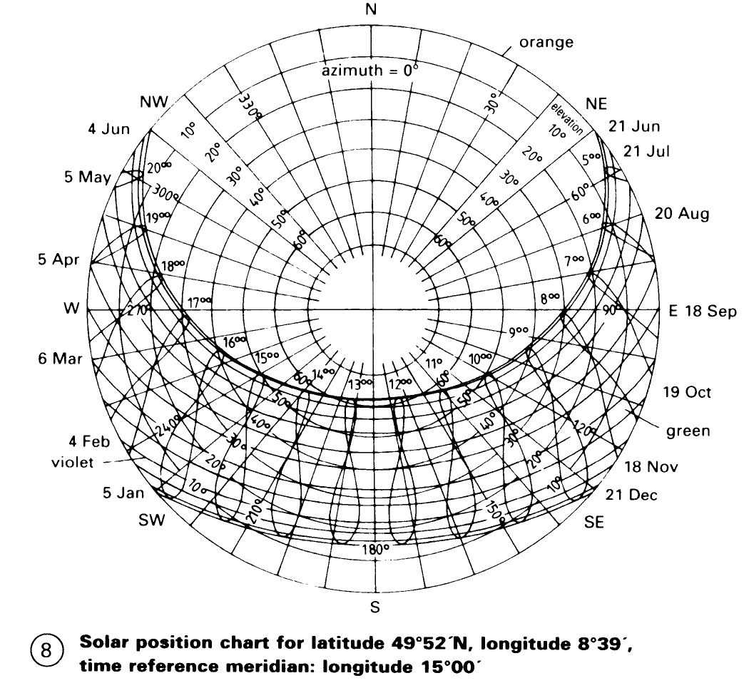
In order to determine the position of the sun, loopshaped curves are given for each hour of the day. In these, violet is used for the first half of the year and green for the second. The looped shape of the hourly curves is attributable to the elliptical path of the Earth and the inclination of the ecliptic. The times shown relate to the given time reference meridian, i.e. to the time zone of the location in question.
The intersection points of the daily curves with hourly curves of the same colour mark the position of the sun at any hour of the day. On the orange coloured polar diagram, the position of the sun can be read off as an angle of direction of the sun (azimuth) and angle of elevation of the sun (height) - (8).
Date added: 2023-01-01; views: 1125;