Fracture Zone Aquifers and Groundwater Systems: Types, Movement, and Dissolution
Most wells fill with water simply because they intersect the water table. However, subsurface rocks are not always homogeneous, which can produce a complex type of water table known as a perched water table. Perched water tables result from discontinuous impermeable rock or soil bodies in the subsurface, creating domed pockets of water at elevations higher than the main water table, resting atop the impermeable layer.
Aquifers and Their Properties. Aquifers are any body of permeable rock or regolith saturated with water through which groundwater moves. The term aquifer is usually reserved for rock or soil bodies that contain economical quantities of water extractable by existing methods. The quality of an aquifer depends on two main properties: porosity and permeability. Porosity measures the total amount of open void space in the material, while permeability refers to the ease with which a fluid can move through open pore spaces, depending in part on the size, shape, and connectivity of individual pores.
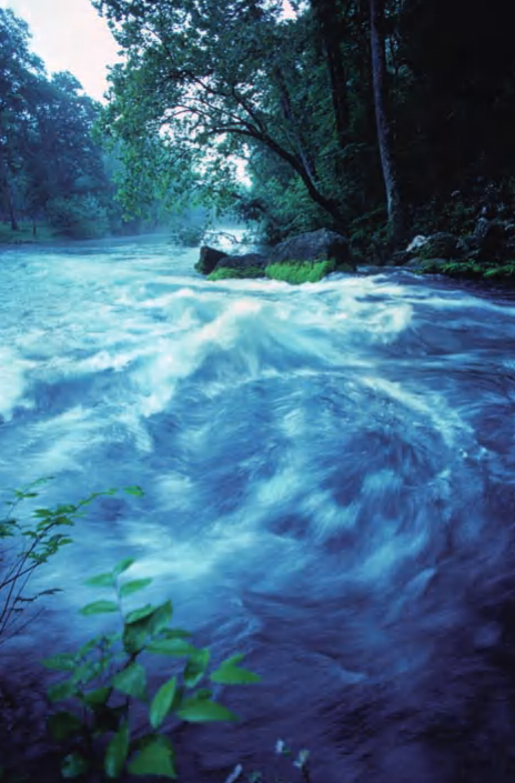
Big Spring, Missouri
Gravels and sandstone make good aquifers, as do fractured rock bodies. Clay is so impermeable that it forms poor aquifers and typically creates aquicludes, which stop water movement. There are several main types of aquifers. In uniform, permeable rock and soil masses, aquifers form as a uniform layer below the water table, where wells fill with water simply by intersecting the water table.
When the upper boundary of groundwater in an aquifer is the water table, the aquifer is said to be unconfined. In many regions, a permeable layer (typically sandstone) is confined between two impermeable beds, creating a confined aquifer. In such systems, water enters only through a small recharge area; if this area lies in the mountains, the aquifer may be under considerable pressure, forming an artesian system.
Water escaping from fractures or wells reflects the pressure difference between the source area and the discharge area (the hydraulic gradient) and rises above the aquifer as an artesian spring or artesian well. Some artesian wells have produced fountains spewing water 200 feet (60 meters) high. One example is the artesian system in Florida, where water enters the recharge area and is released near Miami approximately 19,000 years later.
Fracture Zone Aquifers. Hydrologists, geologists, and municipalities increasingly appreciate that significant quantities of fresh water are stored in fractures within otherwise impermeable crystalline rocks beneath the ground. Many buried granite and other bedrock bodies are cut by numerous fractures, faults, and cracks, some of which contain open spaces. Fractures at various scales represent zones of increased porosity and permeability; they may form networks capable of storing and carrying vast amounts of water. These groundwater systems, called fracture zone aquifers, are similar in some ways to karst systems.
The concept of fracture zone aquifers explains groundwater behavior in large fault‑controlled watersheds. Fault zones serve as collectors and transmitters of water from one or more recharge zones, with surface and subsurface flow strongly controlled by regional fault patterns. Both the yield and the quality of water in these zones are usually higher than average wells in any rock type. High‑grade water for such a region would be 250 gallons (950 liters) per minute or greater, and total dissolved solids measured in water from high‑yielding wells are typically lower than the regional average.
The quality and amount of water obtainable from fracture zone aquifers are influenced by the pattern of fractures and their related secondary porosity over an entire watershed area. Understanding how fracture patterns vary across a basin is essential to determine the unique effects of secondary porosity on groundwater flow, infiltration, transmissivity, and storage, and ultimately to locate and use water within fractures.
Variations in precipitation over the catchment area determine how a fracture zone aquifer system is recharged. Orographic effects occur when precipitation over mountains is substantially greater than at lower elevations. Rainfall is collected over a large catchment area containing zones of high permeability due to intense bedrock fracturing associated with major fault zones. The multitude of fractures within these highly permeable zones “funnels” water into other fracture zones down‑gradient, potentially forming a network hundreds of square miles in area.
Fault and fracture zones serve as conduits for groundwater and often act as channelways for surface flow. Their intersections form rectilinear drainage patterns sometimes exposed at the surface but also present below ground, converging down‑gradient. In some regions, these rectilinear patterns are not visible on the surface due to vegetation and sediment cover. The convergence of groundwater conduits increases the amount of water available for recharge. The enhanced permeability, water volume, and water‑to‑mineral ratio within fault‑fracture zones help maintain water supply quality.
These channels occur in fractured, nonporous media (crystalline rocks) as well as in fractured, porous media (sandstone, limestone). At some point in the groundwater course after convergence, the gradient decreases. Sediment cover over the major fracture zone becomes thicker and acts as a water storage unit with primary porosity. The major fracture zone functions both as a transmitter of water along conduits and as a water storage basin along connected zones with secondary (and/or primary) porosity.
Groundwater within this layer or lens often flows at accelerated rates, resulting in pressurization of groundwater both in the fracture zone and in surrounding material. Rapid flow in the conduit may be replenished almost instantaneously from precipitation. Surrounding materials are replenished more slowly but also release water more slowly, serving as a storage unit to replenish the conduit between precipitation events. Once the zones are saturated, any extra water that flows into them will overflow if an exit is available.
In a large‑area watershed, it is likely that water flows along subsurface channelways under pressure until an exit is found in the confining environment. Substantial amounts of groundwater may flow along the main fault zone controlling the watershed and may vent at submarine extensions of the fault zone, forming coastal or offshore freshwater springs.
Characteristics and Importance of Fracture Zone Aquifers. Fracture zone aquifers are most common in areas underlain by crystalline rocks that have undergone multiple deformational histories including several faulting events. They are especially applicable in regions where recharge is possible from seasonal or sporadic rainfall on mountainous areas adjacent to flat desert lands. These aquifers are distinguished from horizontal alluvial or sedimentary formation aquifers by five key characteristics: (1) they drain extensive areas, many extending for tens of miles (several tens of km); (2) they constitute conduits to mountainous regions with high recharge potential from rainfall; (3) some may connect several horizontal aquifers, thereby increasing the volume of accumulated water; (4) because the water source lies at higher elevations, artesian pressure at the groundwater level may be high; and (5) they are usually missed by conventional drilling because water is often at depths of hundreds of meters.
The characteristics of fracture zone aquifers make them an excellent groundwater source in arid and semiarid environments, where they are increasingly used. Groundwater resources in arid and semiarid lands are scarce and must be properly used and thoughtfully managed. Most of these resources are “fossil,” having accumulated under wet climates during the geological past. Present recharge rates from occasional rainfall are insufficient to replenish the aquifers, so resources must be used sparingly without exceeding optimum pumping rates for each water well field.
Groundwater Dissolution and Karst Terranes. Groundwater also reacts chemically with surrounding rocks; it may deposit minerals and cement grains together, causing reduced porosity and permeability, or form features like stalactites and stalagmites in caves. In other cases, particularly when acidic water moves through limestone, it can dissolve the rock, forming caves and underground tunnels. Sinkholes form where these dissolution cavities intersect the Earth’s surface.
Groundwater dissolution leads to the development of a distinctive class of landforms called karst terranes. In karst areas, caves can collapse, leaving sinkholes and valleys at the surface, and eventually evolve into spectacular towers and pinnacles of nondissolved rock surrounded by former cave passageways. South China is famous for highly evolved karst terranes, whereas parts of the U.S. Midwest are known for well‑developed underground cave systems.
Date added: 2026-04-26; views: 266;