Glaciers: Dynamics, Types, and Role in Climate Systems
A glacier is defined as any permanent body of ice—formed from recrystallized snow—that exhibits evidence of gravitational movement. Glaciers constitute an integral component of the cryosphere, the portion of Earth’s surface where temperatures remain sufficiently low for water to exist primarily in its frozen state. Presently, most glaciers are concentrated in polar regions and at high altitudes, yet throughout Earth’s history, ice masses have repeatedly advanced deep into midlatitude areas, signaling periods of dramatically different global climate. Certain models propose that at one stage ice covered the entire planet, a condition termed Snowball Earth. As dynamic systems, glaciers continuously move under gravity and respond sensitively to shifting global climate patterns, making them valuable indicators of impending environmental changes.
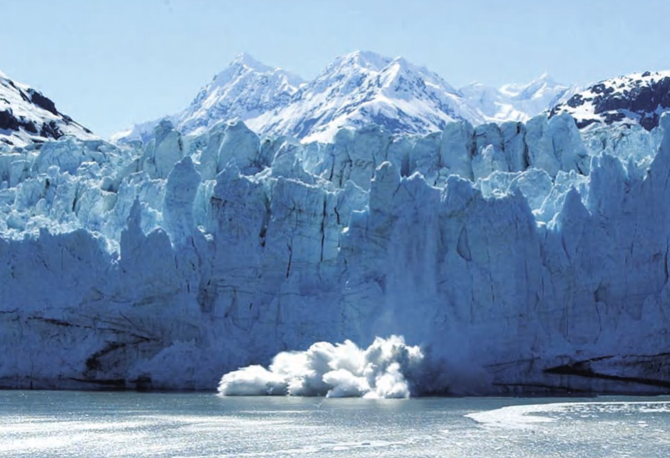
Calving in Glacier Bay National Park, Alaska (Scott Kapich, Shutterstock, Inc.)
Types of Glaciers. Several distinct categories of glaciers exist based on their morphology, setting, and thermal regime. Mountain glaciers develop at high elevations and are confined by surrounding topography such as valleys; specific subtypes include cirque glaciers, valley glaciers, and fjord glaciers. Piedmont glaciers originate from mountain glaciers but terminate on open slopes beyond mountainous terrain. When piedmont or valley glaciers extend into open water, bays, or fjords, they are referred to as tidewater glaciers. Ice caps form dome-shaped accumulations of ice and snow over highland areas, flowing radially outward. Ice sheets represent the largest glacial bodies—continent‑scale masses currently covering Greenland and Antarctica—which together account for approximately 95 percent of all glacial ice on Earth. Should global warming continue to melt these ice sheets, sea level would rise by an estimated 230 feet (70 m). The Antarctic ice sheet, a polar ice sheet divided by the Transantarctic Mountains, includes extensive ice shelves that produce icebergs through calving, many of which drift northward into Southern Hemisphere shipping lanes.
Thermal Classification and Formation. Glaciers are also classified by their temperature regime. Polar glaciers form in regions where the mean annual temperature remains below freezing, exhibiting little to no seasonal melting because temperatures never rise sufficiently. In contrast, temperate glaciers experience seasonal melting periods during which the ice may reach the pressure melting point, allowing both ice and liquid water to coexist throughout the glacier. All glaciers originate above the snow line—the lower elevation limit where snow persists year‑round. This boundary lies at sea level in polar regions and rises to approximately 5,000–6,000 feet (1,525–1,830 m) at the equator, as exemplified by the rapidly retreating glaciers of Mount Kilimanjaro in Tanzania.
The formation of glaciers occurs primarily through the accumulation and compaction of snow, followed by deformation and flow under gravity. Freshly fallen snow has a density roughly one‑tenth that of ice; over time, pore spaces close through pressure and recrystallization. After a year or more, the transitional material becomes firn. Following several years of further compaction, the ice reaches a density of 0.9 g/cm³ and begins to flow under its own weight. At this stage, glaciers are considered metamorphic rocks composed of the mineral ice.
Mass Balance and Glacial Zones. A glacier’s mass and volume fluctuate continually in response to seasonal cycles and long‑term climate variations. The mass balance is determined by the interplay between accumulation (snow and ice gain) and ablation (mass loss through melting, evaporation, or calving). Periods of net mass gain lead to glacial advance, whereas net mass loss results in retreat of the glacier’s terminus.
At the end of the summer ablation season, two principal zones become evident. The zone of accumulation occupies the upper glacier and remains covered by residual snow from the previous winter. Below it lies the zone of ablation, characterized by older, dirtier ice from which the winter snow has completely melted. Separating these zones is the equilibrium line, where the annual accumulation exactly balances ablation.
Movement Mechanisms. Glacial movement initiates when ice thickness becomes sufficient to overcome internal resistance, a threshold dependent on ice temperature and underlying slope. On steep slopes, relatively thin glaciers can flow; on flat terrain, much greater thickness is required. Movement occurs primarily through creep—the deformation of individual ice crystals—which produces preferential grain orientation, forming foliations and lineations analogous to those in other metamorphic rocks.
In some glaciers, a basal layer of meltwater develops, enabling basal sliding and episodic surges. Where ice flows over ridges or steep slopes, tension causes the upper surface to fracture, forming crevasses that can reach depths of 200 feet (65 m). These crevasses may be concealed by thin snow cover, posing hazards to travelers. Within valley glaciers, ice velocity is highest in the central and upper portions, decreasing toward the sides and base due to frictional drag. During surges, basal sliding can temporarily equalize flow rates throughout the ice column as meltwater reduces friction, potentially advancing the glacier several kilometers in a single year.
Glacial Landforms and Erosional Features. Glaciation describes the modification of landscapes by glacial ice. As glaciers move, they pluck and abrade bedrock, transport vast sediment loads, steepen valleys, and leave extensive deposits upon retreat. Characteristic erosional landforms include glacial striations—scratches on bedrock caused by boulders dragged beneath the ice. Roche moutonnées and other asymmetrical bedrock forms develop where glaciers pluck pieces from the lee side, with the steep face oriented in the direction of ice movement. Cirques are bowl‑shaped hollows with steep headwalls, excavated by frost wedging, plucking, and abrasion. Many cirques contain small lakes called tarns, impounded by ridges at their bases. Adjacent cirques produce sharp ridges known as arêtes, and where three or more cirques converge, a steep, pyramid‑like horn forms—the Matterhorn in the Swiss Alps being a classic example.
Glaciated valleys exhibit a characteristic U‑shaped cross‑profile, in contrast to the V‑shaped valleys formed by streams. Tributary valleys often enter the main valley as hanging valleys with waterfalls. Fjords represent deeply incised glacial valleys partially inundated by the sea.
Depositional Features. Glaciers deposit large quantities of sediment, collectively termed glacial drift. Till is unsorted sediment deposited directly by ice, characterized by a random mixture of rock fragments ranging from boulders to fine silt. Moraines are ridge‑like accumulations of till found at glacier margins. Terminal moraines mark the farthest advance of a glacier’s terminus; recessional moraines record temporary stillstands or minor readvances during overall retreat. Lateral moraines form along glacier sides, while medial moraines develop where two glaciers merge.
Drumlins are streamlined, elongate hills formed beneath glacial ice, composed either of till or bedrock. Kettle and knob topography arises where retreating ice leaves buried ice blocks; when these blocks melt, they create depressions (kettle holes) often filled with lakes, surrounded by knolls of outwash sediment.
Glacial erratics are rock fragments transported by ice and deposited atop bedrock of different composition. These erratics frequently originate hundreds or thousands of miles away; tracing them back along glacial striations has enabled discoveries of mineral deposits, including diamond mines in Nunavut, Canada.
Outwash is sediment deposited by meltwater streams, typically in braided channels forming broad outwash plains. As glaciers retreat, diminishing sediment loads may produce a series of outwash terraces. Rock flour—finely ground silt and sand—accumulates at the base of glaciers from crushing and abrasion. Glacial marine drift results from sediment released by icebergs calved into the sea; isolated dropstones within marine sediments serve as key indicators of past glaciation in the geologic record.
Ice Caps and Ice Sheets. Ice caps are dome‑shaped ice masses covering mountainous terrain, flowing radially outward. They are relatively small, covering less than 20,000 square miles (50,000 km²). Ice sheets are analogous but exceed this size; the Greenland and Antarctic ice sheets together contain approximately 95 percent of Earth’s glacial ice. If both were to melt completely, global sea level would rise by about 230 feet (70 m).
The Antarctic ice sheet, centered on the South Pole, dominates its own climate. It is a cold desert with low precipitation and high evaporation; most meltwater refreezes within the snowpack rather than running off. Ice loss occurs primarily through calving and basal melting of ice shelves at rates of 10–15 inches (25–38 cm) per year. In contrast, Greenland’s climate is influenced by warm North Atlantic currents and exhibits significant summer melting and abundant snowfall. Its fast‑flowing outlet glaciers can move miles per year, and the ice sheet is thinning rapidly along its margins, losing an average of 15–20 feet (4.5–6 m) in thickness over the past decade. About half of Greenland’s ice loss results from surface melt runoff, the remainder from calving and submarine melting. These differences mean Greenland contributes more to short‑term sea‑level fluctuations, while Antarctica dominates the long‑term, gradual rise.
Icebergs and Sea Ice. Calving is the process by which ice fragments break from tidewater glaciers, ice shelves, or sea ice, often explosively. The resulting floating ice is termed sea ice or, more commonly, icebergs. Between 81 and 89 percent of an iceberg’s mass lies submerged, depending on its density. Icebergs pose significant hazards to shipping; the most famous disaster was the sinking of the RMS Titanic in 1912.
Sea ice originates from several sources. Polar sea ice forms in the Arctic Ocean and around Antarctica, typically 10–15 feet (3–4 m) thick. The Arctic ice cap rotates clockwise under the influence of Earth’s rotation; about one‑third is exported annually via the East Greenland Current, becoming hazardous icebergs in the North Atlantic. Pack ice develops in regions such as the Gulf of St. Lawrence, the Bering and Beaufort Seas, and the Seas of Japan and Okhotsk. Pack ice can block shipping lanes, and when driven ashore by winds, it can crush coastal structures and pile up gravel ridges tens of feet high.
Icebergs derived from glaciers present the greatest danger to shipping. In the Northern Hemisphere, most calve from Greenland or Baffin Island, moving south through Davis Strait into North Atlantic shipping lanes. Southern Hemisphere icebergs primarily originate from Antarctica. Modern tracking using satellites, radio transmitters, and advanced radar has greatly improved safety, though icebergs still threaten offshore drilling platforms and seafloor pipelines in high‑latitude regions.
Glaciers as Climate Indicators. Glaciers are exceptionally sensitive to climate change, shrinking during warming periods and advancing during cooling intervals. They are often likened to “canaries in the coal mine” for global climate shifts. Earth has experienced at least three major ice ages: the Snowball Earth episode of the Late Proterozoic (approximately 710–650 million years ago), the Late Paleozoic ice age (about 350–250 million years ago), and the current ice age that began roughly 55 million years ago. These glaciations were driven by factors including continental configuration, ocean currents, variations in solar radiation, and changes in atmospheric radiation balance.
Global sea level has risen nearly 400 feet (120 m) since the last glacial maximum approximately 20,000 years ago, with about six inches (15 cm) of that rise occurring in the past century. The rate appears to be accelerating, currently estimated at up to one inch (2.5 cm) per decade. Approximately 100 million people live within 3.2 feet (1 m) of present sea level; rapid sea‑level rise would result in widespread flooding, accelerated coastal erosion, and rising water tables, posing an unprecedented socioeconomic challenge.
Date added: 2026-04-26; views: 270;