
Coastal Geomorphology: Exploring Major Zones, Primary and Secondary Coasts
Major Zones of the Coast: Defining Coastal Areas, Shores, and Beaches. The coasts of the world’s continents are the dynamic interfaces where the land meets the sea. The terms coast, coastal area, and coastal zone are used to describe these land edges that border the sea, including areas of cliffs, dunes, beaches, bays, coves, and river mouths, as illustrated in figures 11.1 and 11.2. The width of the coast, or the distance to which the coast extends inland, varies and is determined by local geography, climate, and vegetation, as well as the perception of the limits of marine influence in social customs and culture. However, the coast is most generally described as the land area that is or has been affected by marine processes such as tides, winds, and waves, even though the direct effect of these processes may be felt only under extreme storm conditions. The seaward limit of the coast usually coincides with the beginning of the beach or shore but sometimes includes nearby offshore islands.
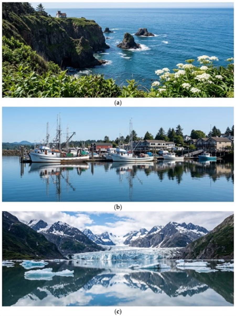
Fig. 11.1. (a) The Oregon coast is famed for its bold rocky headlands and its intervening pocket beaches. (b) Bayou La Loutre at Yscloskey, Louisiana. The bayou is an old stream course of the Mississippi River. The salt content of the water changes as the wind drives fresh water from the river or salt water from the coast through the delta. (c) Glacier bays and fjords produce a rugged topography along the coast of Glacier Bay in southeastern Alaska.
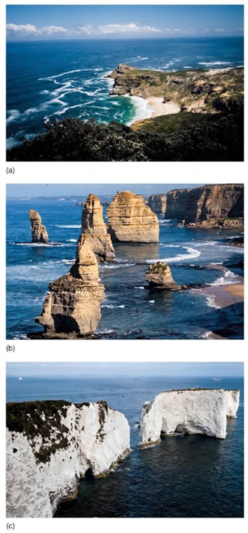
Fig. 11.2. (a) Cape of Good Hope, South Africa, where the Indian and Atlantic oceans meet. (b) Sea stacks are common features along the southern coast of Australia, occurring in a wide variety of shapes and sizes. These sea stacks are part of a group called the Twelve Apostles. (c) These chalky cliffs along the Dorset coast of England were formed from the remains of microscopic, single-celled foraminifera, principally Globigerina.
The Coastal Zone in Legal and Scientific Context. The term coastal zone includes the open coast as well as the semi-isolated and sheltered bays and estuaries that interrupt it. The coastal zone incorporates land and water areas and has become the standard term used in legal and legislative documents affecting U.S. coastal areas. In these circumstances, the coastal zone's landward boundary is defined by a distance (often 200 feet) from some chosen reference point, usually high water; the seaward boundary's limit is defined by state and federal laws.
Dynamics of Coastal Areas. Coastal areas are regions of change in which the sea acts to alter the shape and configuration of the land. Sometimes these changes are extreme and occur rapidly (for instance, the damage caused by a hurricane). Sometimes the changes are subtle and so slow that they are not perceived by people during their lifetimes but are very impressive when considered over long periods (for example, the formation of the Mississippi River delta or the gradual erosion of Cape Hatteras, North Carolina). In general, coasts that are composed of soft, unconsolidated materials, such as sand, change more rapidly than coasts composed of rock. Over the life of the Earth, coasts have changed dramatically as they have emerged and submerged with tectonic processes, climatic variations, and changing sea level; some remnants of these changes can still be seen in present coastlines.
Defining the Shore and the Beach. The shore is a part of the coast; it is that region from the outer limit of wave action on the bottom (seaward of the lowest tide level) to the limit of the waves' direct influence on the land. This land limit may be marked by a cliff or an elevation of the land above which the sea waves cannot break. Such features act as barriers to the wave-tossed drift of logs, seaweeds, and human debris. Conversely, the beach is an accumulation of sediment (sand or gravel) that occupies a portion of the shore. The beach is not static but moving and dynamic, because the beach sediments are constantly being moved seaward, landward, and along the shore by nearshore wave and current action. Between the high tide mark and the upper limit of the shore, there may be dunes or grass flats dotted with drift logs left behind by an exceptionally high tide or a severe storm (fig. 11.3).
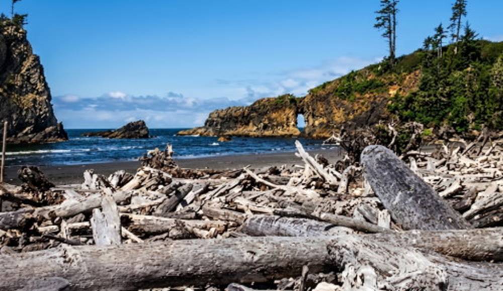
Fig. 11.3. Driftwood accumulates at the high-tide line in areas where timber is plentiful.
Coastal Dynamics and the Classification of Coastlines. Any land form is the product of the processes that have changed it through time, and the study of land forms and the processes that have fashioned them is known as geomorphology. Coastal geomorphology considers tectonic processes; wave, wind, and current exposure; tidal range and tidal currents; sediment supply and coastal transport; and climate and climate changes. Coasts may be classified as erosional or depositional depending on whether they predominantly lose or gain sediments. In the United States most eastern seaboard coasts are passive, or trailing, margin coasts, and they are considered depositional. In general, western seaboard coasts are active, or leading, margin coasts that border on subduction zones, and these are considered erosional. Do not confuse these categories with U.S. coastal erosion problems that are found mainly along the U.S. eastern coast. The formation of trailing margin coasts and leading margin coasts is discussed in chapter 2.
Coasts of both types have been modified by sea-level changes related to climate change; some coasts (both erosional and depositional) have been eroded and their sediments swept away to be deposited elsewhere, while other coasts of both types have received sediments from rivers and shore currents. In some parts of the world, coasts are modified by seasonal storms; other areas enjoy more benign weather. Coasts of polar regions are modified by their interaction with sea ice; tropical coasts are altered by reef-building corals. Each coast has its own identity, but different types of coasts can be recognized as the results of certain processes.
A system devised by the late Francis P. Shepard of the Scripps Institution of Oceanography organizes coasts into two process categories:
(1) coasts that owe their character and appearance to processes that occur at the land-air boundary
(2) coasts that owe their character and appearance to processes that are primarily of marine origin.
Further classification depends on whether their large-scale features are the product of tectonic, depositional, erosional, volcanic, or biological processes. In the first category are coasts that have been formed by
(1) erosion of the land by running surface water, wind, or land ice, followed by a sinking of the land or a rise in sea level;
(2) deposits of sediments carried by rivers, glaciers, or the wind;
(3) volcanic activity, including lava flows; and
(4) uplift and subsidence of the land by earthquakes and associated crustal movements.
Coasts formed by these processes are primary coasts, since there has not yet been time for the sea to substantially alter or modify the appearance given to them by nonmarine processes. The second category includes coasts formed by
(1) erosion due to waves, currents, or the dissolving action of the seawater;
(2) deposition of sediments by waves, tides, and currents; and
(3) alteration by marine plants and animals.
These coasts are secondary coasts; their character, even though it may have been originally land-derived, is now distinctly a result of the sea and its processes. A relatively young coast may be rapidly modified by the sea, while a coast that is old may retain its land-derived characteristics. Keep in mind that absolute age is not really important because the classification is based only on whether the characteristics are derived from the land or from the sea, and it is possible to find both types of features along the same coast.
Primary Coasts: Land-Derived Coastal Features. Coasts formed by erosion at the land-air boundary followed by a sinking of the land or a rise in sea level include those that were covered by glaciers during the ice ages. During these glacial periods, sea level was lower than it is at present because much of the water was held as ice on the continents. Glaciers moved slowly across the land, scouring out valleys as they inched along to the sea. The weight of the ice caused the land to subside, and in some cases, when the ice began to melt, sea level rose faster than land could rebound upward from its depressed state. In other cases, the glacial troughs were scoured below sea level and filled with seawater as the ice receded.
Glacial Erosion and Fjord Formation. The fjords of Norway, Greenland, New Zealand, Chile, and southeastern Alaska are the results of these processes (fig. 11.4). Fjords are long, deep, narrow channels with a U-shaped cross section. Where the glacier met the sea, there was often a collection of debris that formed a lip, creating a shallow entrance, or sill. When a glacier or ice sheet ceases its forward motion and retreats, it leaves a mound of rubble, called a moraine, along the border of its greatest extension. If the glacier has reached the edge of a continent, this material becomes a part of the coastal area. Long Island, off the New York and Connecticut coasts, and Cape Cod, Massachusetts, are moraines. Moraines act as protective barriers to the continental coast.
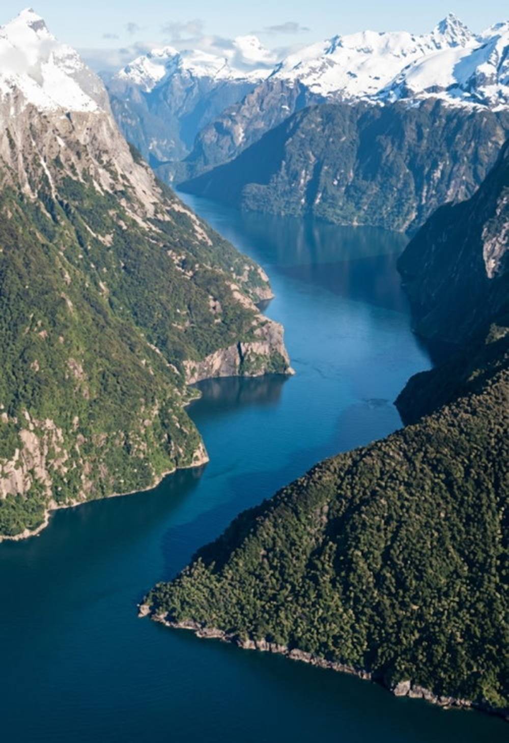
Fig. 11.4. The narrow channel of a fjord, Milford Sound, New Zealand.
In some areas, land that was heavily covered by ice during the last ice age is still slowly rising; in Scandinavia the rate of rise is about 1–5 cm (0.4–2 in) per year. Along other coasts, tectonic forces rather than loss of ice have caused land uplift. Along the western coasts of North and South America old wave-cut terraces can be identified now well above sea level. When sea level was lowered during the ice ages, rivers flowed over the exposed shore to the sea. The river flow cut V-shaped river and stream channels into these areas, and in many cases the channels had numerous side branches formed by feeder streams. As the sea level rose, these channels were filled with seawater, producing areas such as Chesapeake Bay and Delaware Bay on the eastern coast of the United States. A coast of this type is called a drowned river valley, or ria coast, shown in figure 11.5.
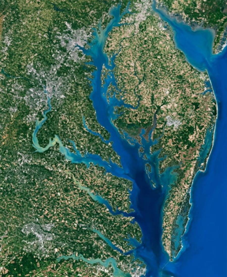
Fig. 11.5. Delaware Bay (upper right) and Chesapeake Bay (center) are examples of drowned river valleys.
Drowned River Valleys, Deltas, and Alluvial Plains. Rivers carrying extremely heavy sediment loads build deltas on top of the continental shelves. The delta, or deposit of river-borne sediment left at a river mouth, produces a flat, fertile coastal area. Examples of these deposits are found at the mouths of the Mississippi, Ganges, Nile, and Amazon rivers. A similar type of coast is produced when the eroded materials carried down from the hills by surface runoff and many small rivers join together to form an alluvial plain. The eastern seacoast of the United States south of Cape Hatteras was produced in this way.
It is estimated that every second, the rivers of the world carry 530 tons of sediment to the sea. This rate of removal is equal to the erosion of a layer 6 cm (2.4 in) thick from all land above sea level every 1000 years. This sediment helps to form and maintain the world's beaches, and much of it finally finds its way to the deep-ocean floor. All of it passes through the coastal zone and takes part in coastal processes. Refer to chapter 3 for sources of terrigenous material.
Dune, Volcanic, and Fault Coasts. A dune coast is a wind-modified depositional coast. In Africa, the Western Sahara is gradually growing westward toward the Atlantic Ocean as the prevailing winds move sand from the inland desert to the coast. Along other dune coasts, for example along central and northern Oregon (fig. 11.6), the winds move the sands inland to form dunes; elsewhere dunes driven by the wind migrate along the shore.
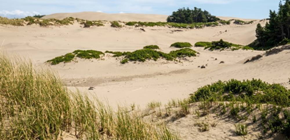
Fig. 11.6. Coastal sand dunes near Florence, Oregon.
The Hawaiian Islands are the tops of large seamounts and have excellent examples of coasts formed by volcanic activity. Lava flows extending to the sea form black sand beaches or lava coasts. Volcanic explosions just beneath the sea surface at the water's edge formed craters that became concave bays when they lost their rims on the seaward side, forming cratered coasts (fig. 11.7).
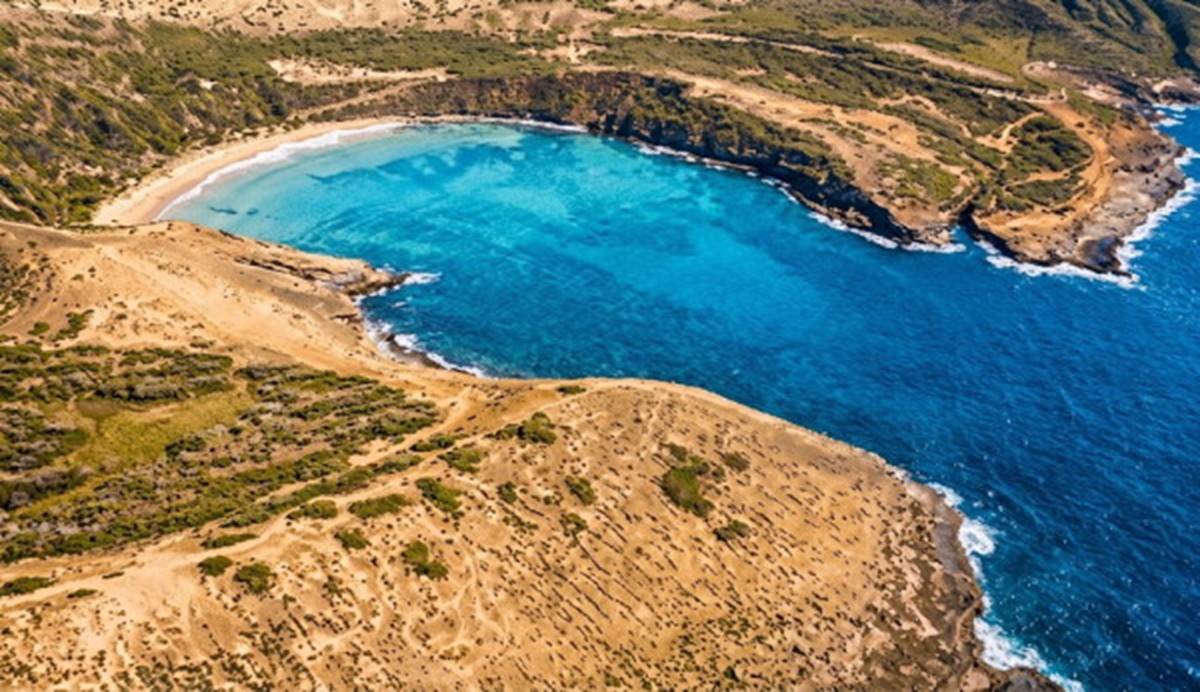
Fig. 11.7. A volcanic crater coast, Hanauma Bay, Hawaii, is a crater that has lost the seaward portion of its rim. Today it is a park and marine preserve.
When tectonic activity results in faulting and displacement of the Earth's crust, the coast is changed in characteristic ways. The California San Andreas Fault system lies along a boundary where crustal plates are moving parallel to each other along a transform fault. (Plate movements and transform faults are described in chapter 2.) Over long periods of time, faults formed in this area filled with seawater. The Gulf of California, also known as the Sea of Cortez, located between Baja California and the mainland of Mexico, is found at the southern end of the fault system. At the northern end lie San Francisco and Tomales Bays, where the fault runs out into the Pacific Ocean. Tomales Bay is a particularly good example of a fault bay. See the satellite image of this fault system in figure 11.8. In other parts of the world, the Red Sea and the Scottish coast provide examples of fault coasts.
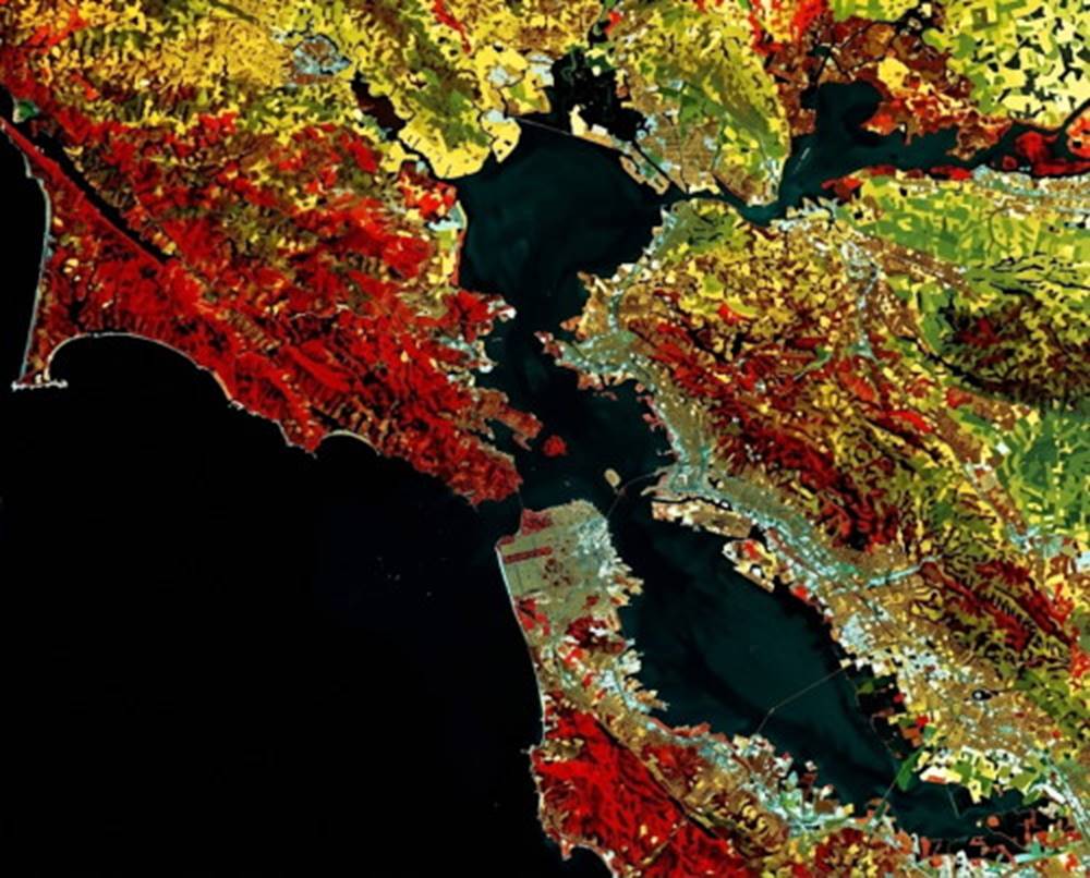
Fig. 11.8. The San Andreas Fault runs along the California coast to the west of San Francisco, separating Point Reyes from the mainland and producing Bolinas and Tomales bays. Tomales Bay is seen as a dark line at the upper left.
Secondary Coasts: Marine-Derived Coastal Features. Secondary coasts owe their present-day appearance to marine processes. As waves batter against the coast, they constantly erode and grind away the shore; rocks and cliffs are undercut by the wave action and fall into the sea, where they are ground into sand. A coastal area formed of uniform material may have been irregular in shape and composed of headlands and bays at one time, but the concentrated energy of the waves wears down the headlands more rapidly than the straighter shore and cove areas. With time, a more regular coastline results; examples are found in southern California, southern Australia, New Zealand (fig. 11.9), and England's cliffs of Dover. If the original coastline is made up of materials that vary greatly in composition and resistance to wave erosion, the result will be an increasingly irregular coastline of hard rock headlands separated by sand coves. In some places, such as northern California, Oregon, Washington, Australia, and New Zealand, the headlands erode irregularly and small rock islands and tall slender pinnacles of resistant rock are formed; these are known as sea stacks (figs. 11.2b and 11.10). Headlands still connected to the mainland are undercut to produce sea caves or are cut through to produce arches or small windows.
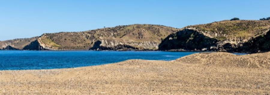
Fig. 11.9. A cliffed coast made regular by erosion, New Zealand.
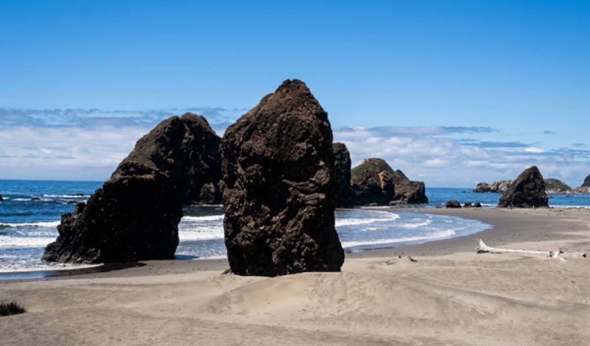
Fig. 11.10. Sea stacks are common features along the coasts of northern California, Oregon, and Washington. They occur in a wide variety of shapes and sizes.
In some cases, eroded materials are carried seaward by the waves and currents to areas just off the coast. If sufficient sand material is deposited in offshore shallows paralleling the beach, bars are produced. If still greater amounts of material are added, the bars may grow until they break the surface and form barrier islands (fig. 11.11). The barrier islands of the southeastern coast of the United States were formed during a period of rising sea level; seawater flooded low coastal areas, isolating the high dunes at the sea's edge and converting a primary coast to a secondary coast. Once a barrier island has formed, plants begin to grow and the vegetation helps to stabilize the sand and increase the island's elevation by trapping sediments and accumulating organic matter.
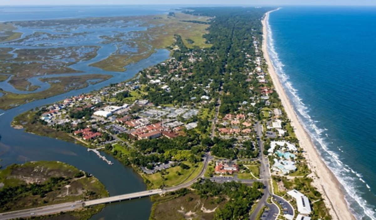
Fig. 11.11. Sea Island, Georgia, is a barrier island that has been extensively developed. The shallow water between the island and the coast is visible on the left.
Barrier Islands, Sand Spits, and Reef Coasts. A line of barrier islands along a coast protects the continental coastline from storm waves and erosion, but the islands sustain the damage that the continental coast is spared. During 1989's Hurricane Hugo, Folly Island, along the coast of South Carolina, suffered extensive storm damage. Eighty-six of 290 oceanfront structures were more than 50% destroyed, and fifty were damaged beyond repair. The U.S. National Flood Insurance Program issued nearly $3 million in damage payments to Folly Island property owners. In 1997 Tropical Storm Josephine moved eastward across the Gulf of Mexico toward Florida. This storm did not develop hurricane-force winds, but it did cause extensive damage to coastal areas of Texas in the vicinity of Galveston, which is located on a barrier island. Josephine remained 482 km (300 mi) off the coast, producing steady, onshore winds of approximately 12 m/s (22 mi/h) for over a hundred hours. The winds raised the sea level at Galveston 80 cm (32 in) above normal high-tide levels and caused average wave heights of 3.5 m (11 ft) along the coast. The sustained period of high water and wave action brought by this minor storm produced severe, hurricane-like beach erosion, loss of homes, and loss of the dunes that stood between the remaining homes and the water. Attempts are made to halt storm-caused erosion by building seawalls and beach-holding devices, but these do not always prove successful. Although well intentioned, they often result in aggravating the loss of material from barrier islands rather than halting it. Further discussion of beach protection projects is found in chapter 12.
Sand spits and hooks are bars that remain connected to the shore at one end (figs. 11.12 and 12.4). Spits and hooks may grow, shift position, wash away in a storm or rebuild under more moderate conditions. The area between the mainland and these spits and hooks is protected from turbulence and is therefore often the site of beach flats formed of sand or mud. If a spit grows sufficiently to close off the mouth of an inlet, a shallow lagoon is formed. Water percolates through the gravel and sand of the spit, and inside the lagoon the water rises and falls with the tides.
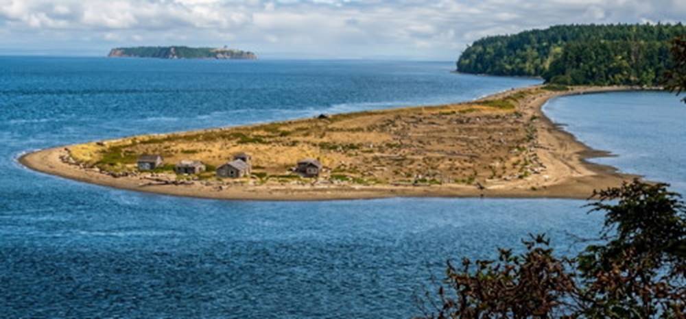
Fig. 11.12. A spit has formed across the entrance to Sequim Bay, Washington.
In the tropical oceans, reef coasts are the result of the activities of sea organisms. Corals grow in the shallow, warm waters surrounding a landmass, and the small animals gradually build a fringing reef, which is attached directly to the landmass. In other places, a lagoon of quiet water may lie between the barrier reef and the land, and in a few cases, the coral encircles a submerged island to form an atoll. The formation of these reef types is discussed in chapter 3, and the life forms that make up the reef are discussed in chapter 17.
The Great Barrier Reef of Australia, stretching along its northeastern coast toward New Guinea, is the largest and most famous of the world's coral reefs. Coral atolls include the Pacific islands of Tarawa, Kwajalein, Eniwetok, and Bikini. The reef-encircled islands of Iwo Jima and Okinawa became familiar as the sites of major battles in the southwest Pacific during World War II. Other marine animals form reeflike structures as their shells are deposited layer on layer, gradually building up a mass of hard material. There are large reef deposits of oyster shells in the Gulf of Mexico off the coasts of Louisiana and Texas. These reefs are so large that the shells are harvested commercially for lime production. Along the eastern coast of Florida, large populations of shell-bearing animals have contributed their shells directly to the shore; small shell fragments form the sand on the beaches.
Mangroves and Salt Marshes. Plants as well as animals may modify a coastal area. Along low-lying coasts in warm climates, mangrove trees grow in shallow water. Their great roots form a nearly impenetrable tangle, providing shelter for a unique community of other plants and animals (fig. 11.13). Coastal mangrove swamps are found along the Florida coast, northern Australia, the Bay of Bengal, and in the West Indies.
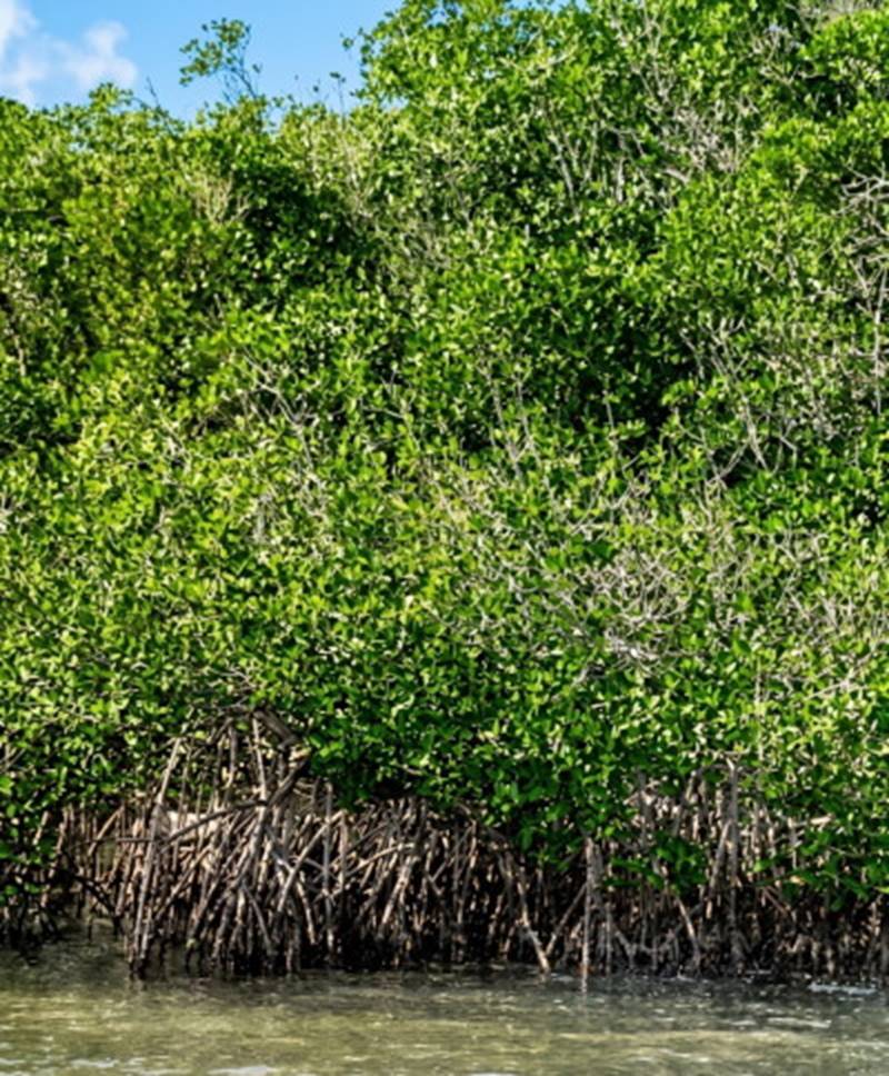
Fig. 11.13. Mangrove trees growing along the shore of Florida Bay.
In more temperate climates, low-lying protected coasts with areas of sand and mud are often thickly covered with grasses, forming another type of plant-maintained environment (fig. 11.14). These salt marshes may extend inland a considerable distance if the land is flat enough to permit periodic tidal flooding. Such marshes also form around protected bays and coves that have large changes in tide level. Salt marshes are extremely productive in terms of organic material and extend the shoreline seaward by trapping sediments. The effect of human activities on mangrove swamps and salt marshes is discussed in chapter 12.
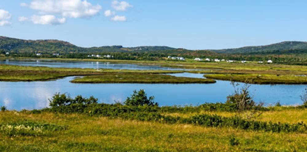
Fig. 11.14. A coastal saltwater marsh, Gaspé, Québec, Canada.
Date added: 2026-11-09; views: 5;