
Cloud Classification, Formation, and Climate Impact: A Scientific Guide
Introduction to Cloud Formation and Classification. Clouds are visible aggregates of minute water droplets or ice crystals suspended in the Earth's atmosphere, primarily within the troposphere. These hydrometeors form through condensation or deposition of water vapor onto microscopic condensation nuclei, such as dust, salt, or pollution particles. The modern system for classifying these atmospheric structures was pioneered in 1803 by the English naturalist Luke Howard, who proposed using Latin terms to categorize clouds by their basic forms: cumulus (heaped), stratus (layered), and cirrus (fibrous). This system was later expanded in 1887 by Ralph Abercromby and H. Hildebrandsson, who introduced height-based categories—high-level, middle-level, low-level, and clouds of significant vertical development—and incorporated the suffix nimbus to denote precipitating clouds, as in the cumulonimbus thunderstorm cloud.
High-Level Clouds: Composition and Types. High clouds typically form above 6,000 meters (19,685 feet) in mid to low latitudes, where temperatures are consistently below freezing, ensuring they are composed almost entirely of ice crystals. The most prevalent type is cirrus, appearing as delicate, wispy filaments often arranged in wind-swept strands, generally indicating fair weather when moving west to east. Cirrocumulus clouds manifest as small, white patches or grains arranged in ripple-like patterns, sometimes creating a "mackerel sky." Cirrostratus are transparent, whitish veils that often cover the entire sky, allowing the sun and moon to be seen and frequently producing optical phenomena like halos or sun dogs due to light refraction through their ice crystals; their advance often signals an approaching warm front and precipitation within 12-24 hours.
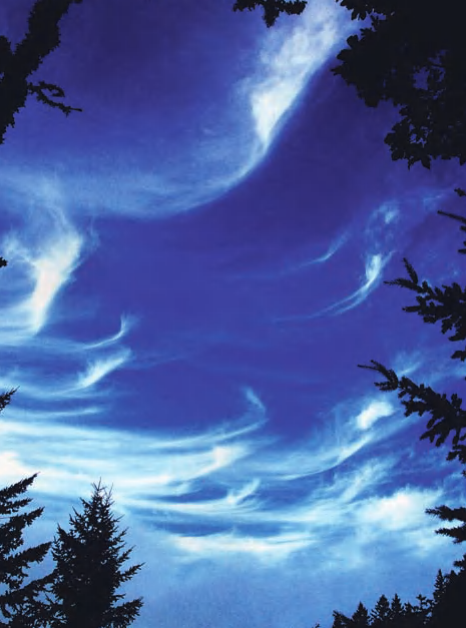
Figure: Cirrus clouds over coast range at Purisima Creek Redwoods, Bay Area, California (NOAA/Department of Commerce).
Middle-Level Clouds: Characteristics and Forecasting. Middle clouds occupy the atmospheric layer between approximately 2,000 and 7,000 meters (6,560-22,965 feet) and consist mainly of supercooled water droplets, though they may contain ice crystals. Altocumulus clouds appear as gray or white layered patches or rolls, often with shaded portions, and are typically less than one kilometer thick; their development, especially in the morning, can signal convective instability and potential afternoon thunderstorms. Altostratus form a continuous, grayish or bluish sheet that diffusely obscures the sun, presenting it as a faint, glowing disk; these clouds are classic harbingers of widespread, steady rain or snow from an advancing frontal system.
Low-Level Clouds: Structure and Precipitation. The bases of low clouds form below 2,000 meters (6,650 feet) and are predominantly composed of water droplets, which can transition to ice or snow in colder conditions. Nimbostratus are dark, amorphous, and thick layers directly responsible for continuous, light to moderate precipitation, often saturating the lower atmosphere. Beneath nimbostratus, one may find rapidly moving, ragged stratus fractus, commonly called scud clouds. Stratocumulus appear as extensive, low, lumpy layers or rolls with breaks of clear sky in between, sometimes allowing dramatic crepuscular rays to filter through. Uniform, featureless stratus clouds resemble elevated fog and frequently occur in coastal regions, particularly during summer months.
Clouds with Vertical Development: Dynamics and Hazards. Some clouds exhibit significant vertical development across multiple atmospheric levels. Cumulus clouds are detached, cauliflower-shaped clouds with flat bases, often forming on fair-weather days. Under conditions of strong atmospheric instability, they can evolve into cumulus congestus (towering cumulus) and ultimately into the massive cumulonimbus, the ultimate thunderstorm cloud. A mature cumulonimbus can span from a few hundred meters to over 12,000 meters (39,370 feet) at the tropopause, with its composition changing from water droplets at the base to a glacial cap of ice crystals at the anvil top. These clouds are engines of severe weather, capable of generating intense precipitation, powerful updrafts/downdrafts, lightning, hail, and even tornadoes, releasing enormous amounts of latent heat energy.
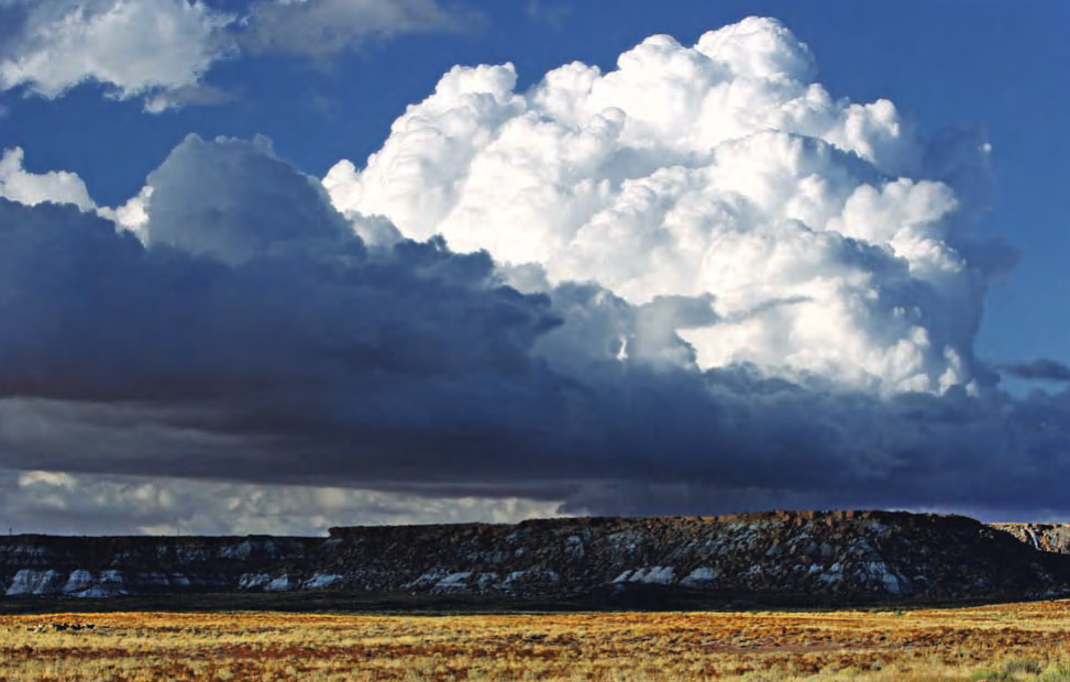
Cumulus cloud over Arizona desert
Unusual and Specialized Cloud Formations. Various specialized clouds form under unique atmospheric conditions. Pileus clouds, resembling a smooth cap or scarf, form over the rising tops of cumuliform clouds. Orographic lifting creates lenticular clouds, which are lens-shaped and stationary downwind of mountain ranges, and banner clouds, which stream from isolated peaks. Mammatus clouds present a dramatic spectacle of pouch-like protuberances on the underside of anvil clouds, forming where cold, saturated air sinks into drier air; similar structures can form under volcanic ash clouds. Anthropogenically, condensation trails (contrails) form from aircraft exhaust, where water vapor condenses and freezes on pollution nuclei; depending on atmospheric humidity, these may dissipate quickly or persist and spread, influencing local cloudiness and potentially contributing to climate forcing.
The Critical Role of Clouds in Earth's Climate System. Clouds exert a profound and complex influence on the planetary radiation budget through competing mechanisms. They possess a high albedo, efficiently reflecting incoming shortwave solar radiation back to space, which produces a net cooling effect on the Earth's surface. Conversely, as they are composed of water and ice, they absorb and re-emit outgoing longwave infrared radiation, enhancing the atmospheric greenhouse effect and causing net warming. The net climatic impact depends on factors like cloud height, thickness, and microphysical composition: generally, low and thick clouds (like stratocumulus) dominate the cooling effect, while thin, high clouds (like cirrus) tend to have a net warming influence. Understanding this delicate balance and its feedbacks is a central challenge in contemporary climate science and modeling.
Date added: 2026-07-14; views: 151;