
Measuring Ocean Currents: Techniques, Doppler Effect, and Energy
Methodological Approaches to Current Tracking. Direct measurements of currents fall into two groups: those that follow a parcel of the moving water and those that measure the speed and direction of the water as it passes a fixed point. Moving waters may be followed with buoys designed to float at predetermined depths. These buoys signal their positions acoustically to a research vessel or shore station; their paths are followed, and their speed and displacement due to the current are calculated.
Surface water may be labeled with buoys or with dye that can be photographed from the air. Buoy positions may also be tracked by satellites using GPS. A series of pictures or position fixes may be used to calculate the speed and direction of a current from the buoys' drift rates. These buoys can be instrumented to measure other water properties such as temperature and salinity (Fig. 8.16).
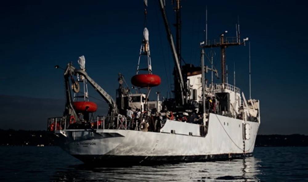
Fig. 8.16. Surface buoys (red) carrying instruments are deployed from the research vessel Thomas G. Thompson.
A variation of this technique uses drift bottles. Thousands of sealed bottles, each containing a postcard, are released at a known position. When the bottles are washed ashore, the finders are requested to record the time and location of the find and return the card. In this case only the release point, the recovery points, and the elapsed time are known; the actual path of motion is assumed.
Sensors used to measure current speed and direction are called current meters. They consist of a rotor to measure speed and a vane to measure direction of flow (Fig. 8.17).
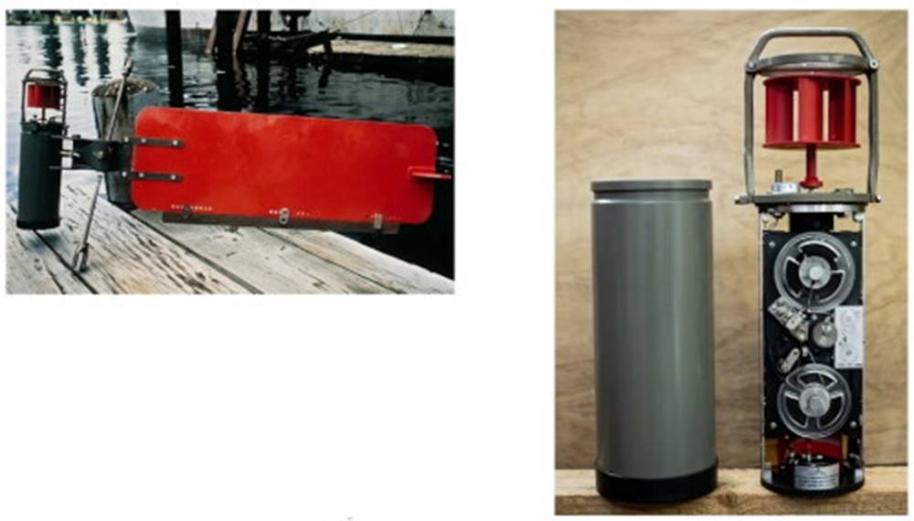
Fig. 8.17. An internally recording Aanderaa current meter. (a) The vane orients the meter to the current while the rotor determines current speed. Inside the protective case (b), the instrument records coded information from its external sensors. The speed and direction of the current, water temperature, pressure, and conductivity of the water are recorded on magnetic tape. A clock controls the frequency at which these data are recorded. The magnetic tape is retrieved when the current meter is picked up from its taut-wire mooring.
Deployment and Recovery of Instrumentation. When the current meter is lowered from a stationary vessel, the measurements can be returned to the ship by a cable, or they can be stored by the meter for reading upon retrieval. If the current meter is attached to an independent, bottom-moored buoy system, the signals can be transmitted to the ship as radio signals or they can be stored on tape in the current meter, to be removed when the buoy and current meter are retrieved.
In order to measure a current at a location, a current meter must not move. Although a vessel can be moored in shallow water so that it does not move, it is very difficult, if not impossible, to moor a ship or surface platform in the open sea so that it will not move and by its motion also move the current meter. The solution is to attach the current meter to a buoy system that is entirely submerged and not affected by winds or waves.
See Fig. 8.18 for a diagram of this taut-wire moorage system. The string of anchors, current meters, wire, and floats is preassembled on deck and is launched, surface float first, over the stern of the slowly moving ship. As the ship moves away the float, meters, and cable are stretched out on the surface. When the vessel reaches the sampling site the anchor is pushed overboard to pull the entire string down into the water. The floats and meters are retrieved by grappling from the surface for the ground wire or by sending a sound signal to a special acoustical link (Fig. 8.18b), which detaches the wire from the anchor. The anchor is discarded, and the buoyed equipment returns to the surface. The technique is straightforward, but many problems can occur in launching, finding, and retrieving instruments from the heaving deck of a ship at sea.
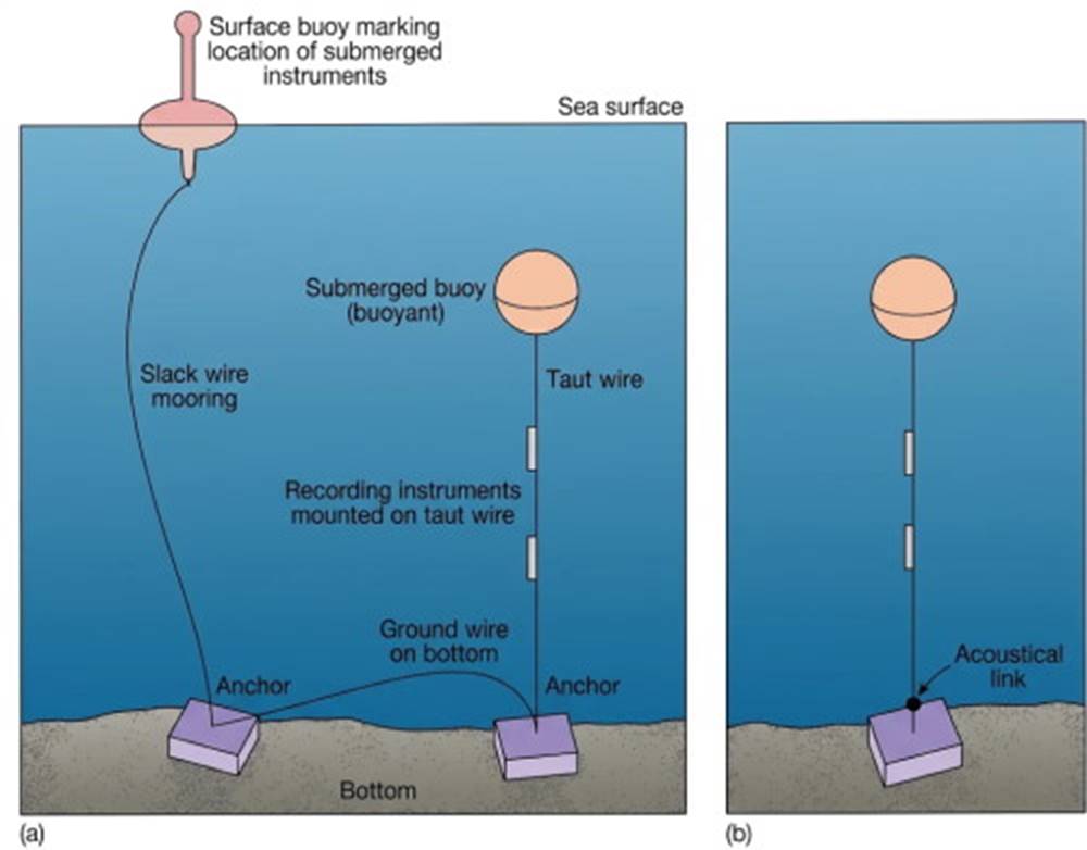
Fig. 8.18. Taut-wire moorage. (a) Recovery is accomplished by retrieving the surface buoy and hauling in the wire. If the surface buoy is lost, it is possible to grapple for the ground wire. (b) In this system, a sound signal disconnects the anchor, and the equipment floats to the surface.
Whenever oceanographers send their increasingly sophisticated equipment over the side, they must cross their fingers and hope to see it again.
Acoustic and Satellite Technologies. A new technique for measuring currents does not need the energy of the moving water to run the rotor of a current meter. This technique uses sound pulses and takes advantage of the change in the pitch, or frequency, of sound as it is reflected from particles suspended in the moving water. When sound is reflected off particles moving toward the meter, the pitch increases; when the sound is reflected off particles moving away from the meter, the pitch decreases.
This is the Doppler effect; the same effect increases the pitch of the horn or siren of an approaching vehicle and decreases the pitch as the vehicle passes and moves away.
To use this effect, the sound source is mounted on a vessel or on a buoy system, or it is placed on the sea floor. A seafloor-mounted Doppler current meter is shown in Fig. 8.19. Four beams of sound pulses, set at a precisely known frequency, are sent out at right angles to each other. The change in pitch of the returning echoes provides the speed and direction of the water moving along each beam of sound pulses, and the resulting current is computed.
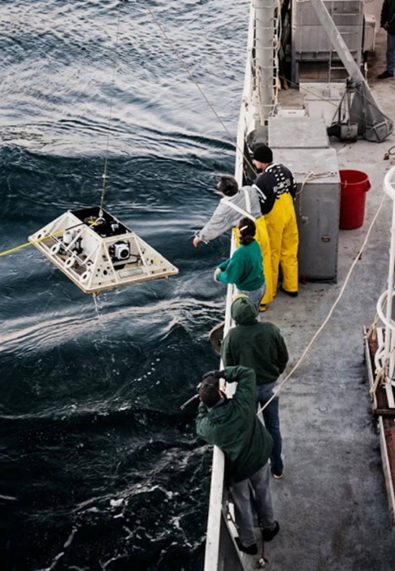
Fig. 8.19. Retrieving a Doppler current meter from the sea floor. The sound signals from the meter are analyzed to determine the speed and direction of the current. Courtesy of Mark Holmes, School of Oceanography, University of Washington.
Using satellite altimeter data, scientists are able to map the topography of the sea surface on a global scale. Surface elevations and depressions are analyzed to determine the roles of gravity, periodic tidal motion, air pressure, and geostrophic flow in producing sea-surface topography. Ocean-wide measurements of this type were not possible until satellite coverage of the oceans became available.
Harnessing Ocean Currents for Power. The massive oceanic surface currents of the world are untapped reservoirs of energy. Their total energy flux has been estimated at 2.8 × 10¹⁴ (280 trillion) watt-hours. Because of their link to winds and surface heating processes, the ocean currents are considered as indirect sources of solar energy. If the total energy of a current was removed by conversion to electrical power, that current would cease to exist; but only a small portion of any ocean current's energy can be harnessed, owing to the current's size.
Harnessing the energy from these open-ocean currents requires the use of turbine-driven generators anchored in place in the current stream. Large turbine blades would be driven by the moving water, just as windmill blades are moved by the wind; these blades could be used to turn generators and to harness the energy of the water flow. (See also the discussion on energy from tidal currents in chapter 10.)
The Florida Current and the Gulf Stream are reasonably swift and continuous currents moving close to shore in areas where there is a demand for power. If ocean currents are developed as energy sources, these currents are among the most likely. But most of the wind-driven oceanic currents generally move too slowly and are found too far from where the power is needed. In addition, the impact on other uses of the sea—transport, fishing, recreation—needs to be considered. The cost of constructing, mooring, and maintaining current-driven power-generating devices in the open sea makes them noncompetitive with other sources of power at this time.
Recapitulation of Current Dynamics and Climate Interactions. Winds push the surface water 45° to the right of their direction in the Northern Hemisphere and 45° to the left in the Southern Hemisphere. This action creates the large surface current gyres observed in each ocean. Southern Hemisphere gyres rotate counterclockwise; Northern Hemisphere gyres rotate clockwise. The currents of the northern Indian Ocean change with the seasonal monsoons. Wind moves the water in layers that are deflected by the Coriolis effect to form the Ekman spiral; net flow over the depth of the spiral is deflected 90°. Geostrophic flow is produced when the force of gravity balances the Coriolis effect.
Large oceanic current systems have names and descriptions based on their average locations. The water transport and speed of a current are affected by the current's cross-sectional area, by other currents, by westward intensification, and by wind speed. Eddies are formed at the surface when a fast-moving current develops waves along its boundary that break off from the parent current. Eddies occur at all depths, wander long distances, and gradually lose their identity.
Downwelling is produced by converging surface currents, and upwelling is produced by diverging surface currents. Upwelling occurs nearly continuously along the western sides of the continents in the trade wind belts, where water diverges from the coast. Seasonal upwellings and downwellings occur in coastal areas that have changing wind patterns and an alternating coastal flow of water onshore and offshore due to the Ekman transport.
Cyclic global circulation changes are part of the Earth's normal dynamic system. Sudden changes in global ocean circulation that may lead to major climate changes are thought to be triggered by localized events in the North Atlantic. Both the North Pacific and the North Atlantic show decadal oscillations in current flow and climate.
A variety of techniques are available to measure currents: by following the water, by measuring the water's speed and direction as it moves past a fixed point, or by using changes in the pitch of sound. Deriving energy from the oceanic current flows is not practical at the present time.
Date added: 2026-11-09; views: 6;