
Tsunami Warning Systems: Seismic Detection and Mitigation
Seismic Detection and Initial Warning Centers. Seismic stations throughout the world locate earthquakes by using the arrival times of P- and S-waves to establish the earthquake epicenters (refer to chapter 2). If an epicenter is oceanic and the earthquake is strong, shallow, and of long duration, and if it also progresses slowly along a fault, then seafloor displacement may occur. It is the vertical displacement of the sea floor that produces the sea-surface disturbance known as a tsunami. The hourly positions of sea waves that radiate out from such an undersea epicenter are then plotted by computer.
Tsunami Prediction and Warning Centers were located in Hawaii and Alaska in 1946 after a tsunami struck Hawaii. This warning network determines arrival times of possible tsunamis along the wave paths and sends a tsunami warning to populated areas, where water-level gauges are watched to see if there is any significant rise or fall in sea level.
Computer Modeling and System Limitations. Computer models that predict tsunamis from seismic data are not yet fully accurate. A model may predict a tsunami that does not exist, or it may fail to predict a true tsunami. Primarily on the basis of seismic data, twenty tsunami warnings have been issued since 1946. Fifteen of these warnings were false alarms. An accurate warning system must be able to sense the actual presence of a tsunami close to its source.
Pacific-wide, Regional, and Local Warning Systems. At the present time, the Pacific-wide system can issue a warning within about one hour of the seismic event. Because of this time lag, such warnings are useful only to populations located more than 750 km (465 mi) from the source. Regional systems (two in the United States: Alaska and Hawaii; one each in Japan, Russia, and French Polynesia) warn in about ten minutes and are useful 100 to 750 km (62–465 mi) from the source. Local systems (Japan and Chile) that warn in about five minutes are useful less than 100 km (62 mi) from the source.
All three systems use location and earthquake data to trigger warnings and then rely on coastal tide stations for verification of the waves. A tsunami does not produce uniform water-level responses at coastal tide stations, for no two harbors or estuaries are exactly the same. Therefore, the data transmitted from one tide station do not forecast what will happen only a short distance away. Until accurate deep-ocean tsunami measurements are available, it will not be possible to forecast site-specific information in hazardous areas.
National Tsunami Hazard and Mitigation Program. In 1996, fifty years after the establishment of the Tsunami Prediction and Warning Centers, the states of Alaska, Washington, Oregon, California, and Hawaii joined with three federal agencies—the National Oceanic and Atmospheric Administration (NOAA), the U.S. Geological Survey (USGS), and the Federal Emergency Management Administration (FEMA)—to fund twelve new seismic stations and two ocean sensing stations in the North Pacific. This is the National Tsunami Hazard and Mitigation Program (see box fig. 9.1).
At present two ocean stations are in place, with bottom-mounted pressure sensors (long-wave detectors) that are linked to surface buoys (box fig. 9.2) that transmit data from tsunamis to satellites. The satellites then relay the information to scientists working in the hazard and mitigation program. One buoy is located due south of Kodiak Island; it monitors any waves generated in the Aleutian Trench or the Gulf of Alaska. The second buoy is due west of the Gorda Ridge, off central Oregon, and monitors the Cascadia subduction zone, which lies between the Gorda-Juan de Fuca Ridge and the west coast of the United States. Six more ocean sensors and thirty-eight additional seismometers will be installed in future years.
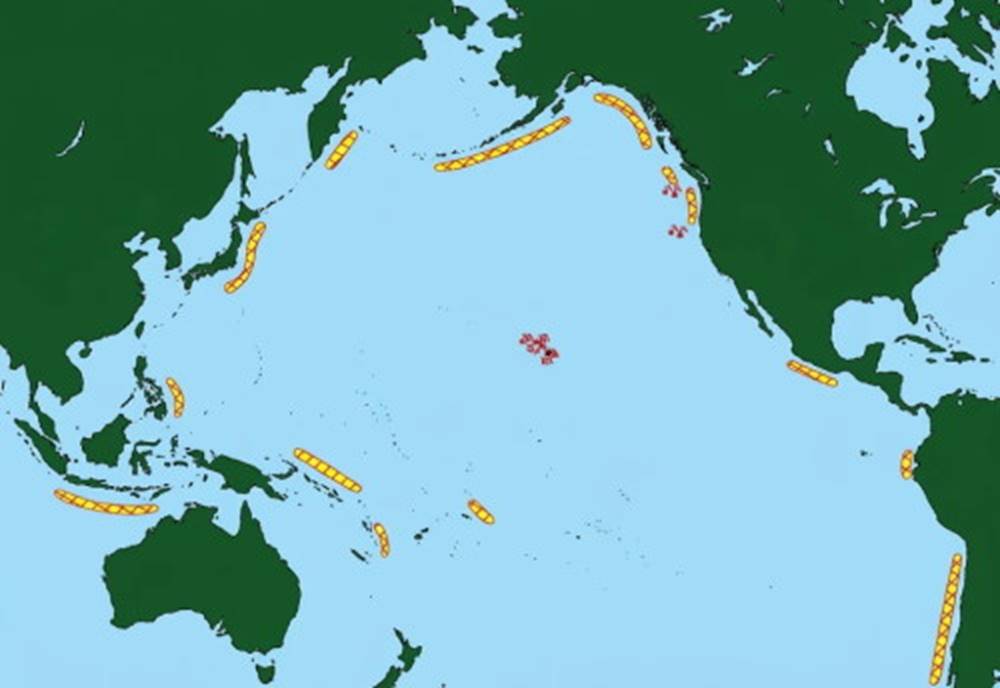
Box fig. 9.1. NOAA Deep Ocean Tsunami Measurement Program. Tsunami reporting stations are shown as small buoys. Two ocean stations (one south of the Aleutian Islands and one west of the Oregon coast) are presently in place; ten more stations are planned for the future. Undersea earthquake zones are associated with the subduction zones (shown in yellow and red) surrounding the Pacific Ocean.
Remaining Challenges and Public Safety Measures. Although more information is now available, the warning problem is not completely solved; distant tsunamis detected by the present warning system provide residents of a threatened area with time to evacuate, but tsunamis that are formed locally give residents only a few minutes to seek safety. The Cascadia subduction zone is very close to the west coast of the United States and Canada, and more than half a million people live in potential tsunami flooding areas.
Residents of Oregon and California would have less than five minutes warning after a large earthquake in this zone; and those living along the more northerly coast might have only twenty to forty minutes. Residents of tsunami-prone areas need to remember that any local earthquake is the signal to move away from the immediate coastline. The mitigation portion of the tsunami warning program is working to assess the local hazards and to educate the public to the situation.
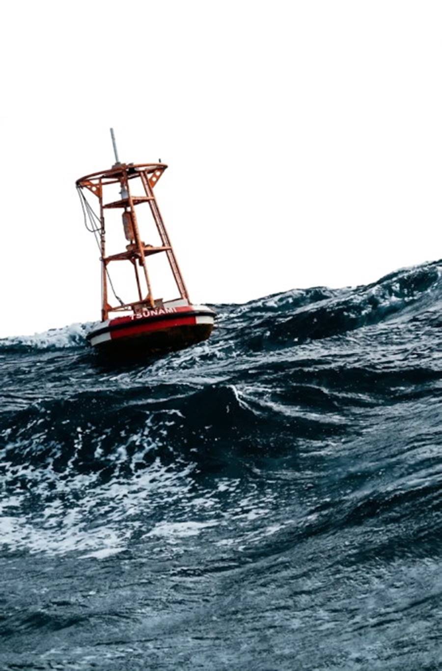
Box fig. 9.2. A tsunami detection buoy in place off the western coast of the United States. The buoy is linked to a sensor resting on the sea floor. Data are transmitted from the buoy to a satellite and relayed from the satellite to tsunami warning centers.
Date added: 2026-11-09; views: 8;