
The Andes Mountains: Geological Formation, Altiplano Plateau, and the Amazon River Basin
The Andes Mountains form a 5,000-mile (8,000-km) continental-scale range along western South America, extending from Venezuela's Caribbean coast to Tierra del Fuego. This towering chain, parallel to the coastline, connects to Central American ranges in the north and Antarctic cordilleras in the south. With numerous snow-capped peaks exceeding 22,000 feet (6,700 m), it ranks as Earth's second-highest mountain belt after the Himalayas. Notable features include Aconcagua, the highest summit on the Argentine-Chilean border, the hyper-arid Atacama Desert in northern Chile, and the expansive Altiplano Plateau within the orogen's great bend in Bolivia and Peru.
The Andean foundation originated in the late Proterozoic and early Paleozoic eras through the accretion of distinct terranes to the Gondwana supercontinent margin. Continued subduction and oceanic terrane accretion produced a broad Paleozoic accretionary wedge. The modern Andes subsequently developed as a continental margin volcanic arc atop these older accreted terranes, driven by subduction of Pacific oceanic plates. This geologically young system experienced major uplift during the Cretaceous and Tertiary periods (the last 100 million years), with ongoing seismicity, volcanism, and uplift strongly segmented by factors like the subducting slab's dip angle and age.
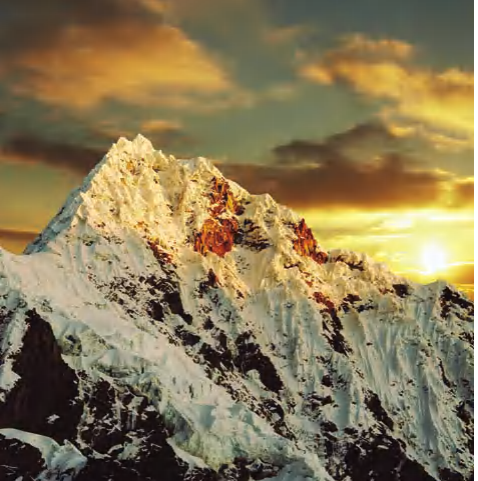
Alpamayo Peak in the Cordilleras Mountains, Peruvian Andes
The Altiplano is a vast, internally drained plateau spanning approximately 65,000 square miles (170,000 km²) at an average elevation of 12,000 feet (3,660 m). This intermontane sedimentary basin is tectonically trapped between the eastern Cordillera Oriental and the western Cordillera Occidental. Characterized by aridity, sparse vegetation, and saline flats, the Altiplano supports localized agriculture and significant mineral extraction.
Lake Titicaca, the world's highest navigable large lake, occupies the northern Altiplano at 12,500 feet (3,815 m), straddling the Peru-Bolivia border. Enclosed by Andean ranges, including the towering Cordillera Real, the lake covers 3,200 square miles and reaches depths of 920 feet (280 m). It is divided by the Strait of Tiquina into two basins: Lake Chucuito (Grande) and Lake Huiñaymarca (Pequeño). Fed by mountain streams and drained primarily by evaporation (95%), its seasonal levels fluctuate around a stable 56°F (14°C) surface temperature, with a salinity of 5.2-5.5 ppt. The lake has been a cultural center since pre-Inca times (over 600 years B.P.), with surrounding ruins like Tiahuanaco and temple sites linked to Inca origin myths.
The northern Andes are drained eastward by the Amazon River, the world's second-longest river at 3,900 miles (6,275 km), originating from the confluence of the Ucayali and Marañón tributaries. Its basin—the largest drainage system on Earth—covers 2.5 million square miles (6.48 million km²), discharging more water than any other river into the Atlantic near Belém. The river flows through a sediment-filled rift basin between the ancient Brazilian and Guiana Shields, creating a vast tropical rainforest and a complex delta with a notable tidal bore. The region hosts significant mineral resources, including gold and manganese, and a biodiverse economy based on timber, rubber, nuts, and medicinal plants.
Historically, the lower Amazon was first explored by European Vicente Yáñez Pinzón in 1500, with the name deriving from Francisco de Orellana's 1540-41 accounts of warrior tribes. Later scientific expeditions by figures like Pedro Teixeira, Charles Darwin, and Louis Agassiz advanced understanding of the river's ecology and geography, with permanent settlement accelerating only after mid-19th century steamship services began.
Date added: 2026-07-14; views: 150;